1420 E Timber Tides Drive
1420 E Timber Tides Drive, Union, WA 98592 · Mason County
$359,500
7.69 acres
22 cumulative days on market
Size
7.69 acres
Price / acre
$46,760
List price ÷ acreage
Annual tax
$1,841
2026 assessment
Listing Broker: Better Properties N. Proctor; Leo Zhuk; 253-906-8970; LeoZhuk@gmail.com
About this parcel
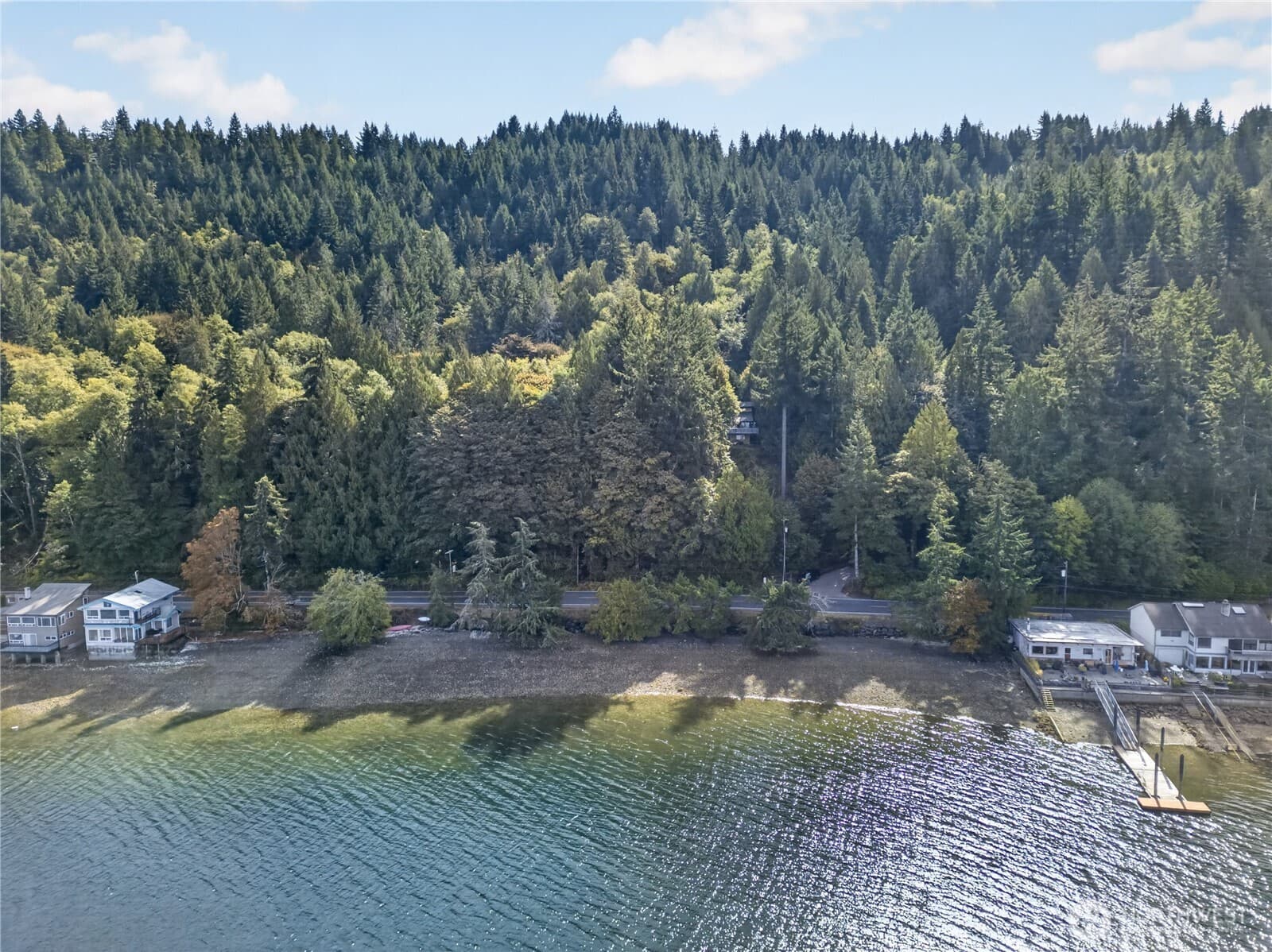
Nearly 7.7 secluded acres at Timber Tides off the south shore of Hood Canal, with over $58K invested in a drilled and equipped well! Three parcels legally combined in 2026 into one large, private tract, newly surveyed with corners set. Approx 494 ft of frontage on E Timber Tides Dr near the end of a dead-end road, bordering Green Diamond timberlands. Relatively level and heavily forested with mature evergreens and salal and huckleberry ground cover. Paved to gravel road access, power in the street, and high-speed fiber internet in the community. A 6-inch domestic well was drilled in 2022 to 520 ft and fitted with a 3 HP submersible pump, with a 15 gpm air test (Ecology well report on file). The WRIA 14 water-use notice is already recorded. A 3-bedroom pressure septic system was designed and approved by Mason County, with test holes and a site plan showing primary and reserve drainfield areas (permit expired; buyer to verify renewal). A 2021 wetland reconnaissance has been completed. Build your home now (with room for a shop and possibly an ADU), or camp and RV here up to six months a year per the CC&Rs. Members enjoy approx 400 ft of private HOA-owned beach on Hood Canal for clamming and oysters. HOA dues cover road and beach upkeep. Minutes to Union's marina, dining, and Alderbrook Resort & Golf. Outside the flood zone. RR5 zoning. Survey and reports available. Buyer to verify well, septic, power, critical areas and buffers, CC&Rs, and permitted uses.
Written by the listing broker. On land this is the primary source for anything beyond price, acreage, and utilities — the MLS publishes no structured zoning, topography, or water-right data — so read it closely, and verify it.
Highlights
- Dead End Street
Location
A single point from the MLS, not a boundary. Parcel lines come from the county assessor and a survey — ask us for the map before you walk it.
 MLS #2592320Updated
Listing information is provided courtesy of the Northwest Multiple Listing Service (NWMLS). The information contained in this listing has not been verified by Cascadian Farm and Land and should be independently verified. Data is deemed reliable but is not guaranteed. Copyright © 2026 Northwest Multiple Listing Service. All rights reserved.