9999 Seven Sisters Road
9999 Seven Sisters Road, Port Ludlow, WA 98365 · Jefferson County
$125,000
40,946 sq ft · 0.94 acre
3 cumulative days on market
Size
40,946 sq ft · 0.94 acre
Price / sq ft
$3.05
Lots under 2 acres are quoted by the lot, not the acre
Annual tax
$645
2026 assessment
Listing Broker: Windermere R.E. Port Townsend; Jim Fox; 360-385-9344; jimfox@windermere.com
About this parcel
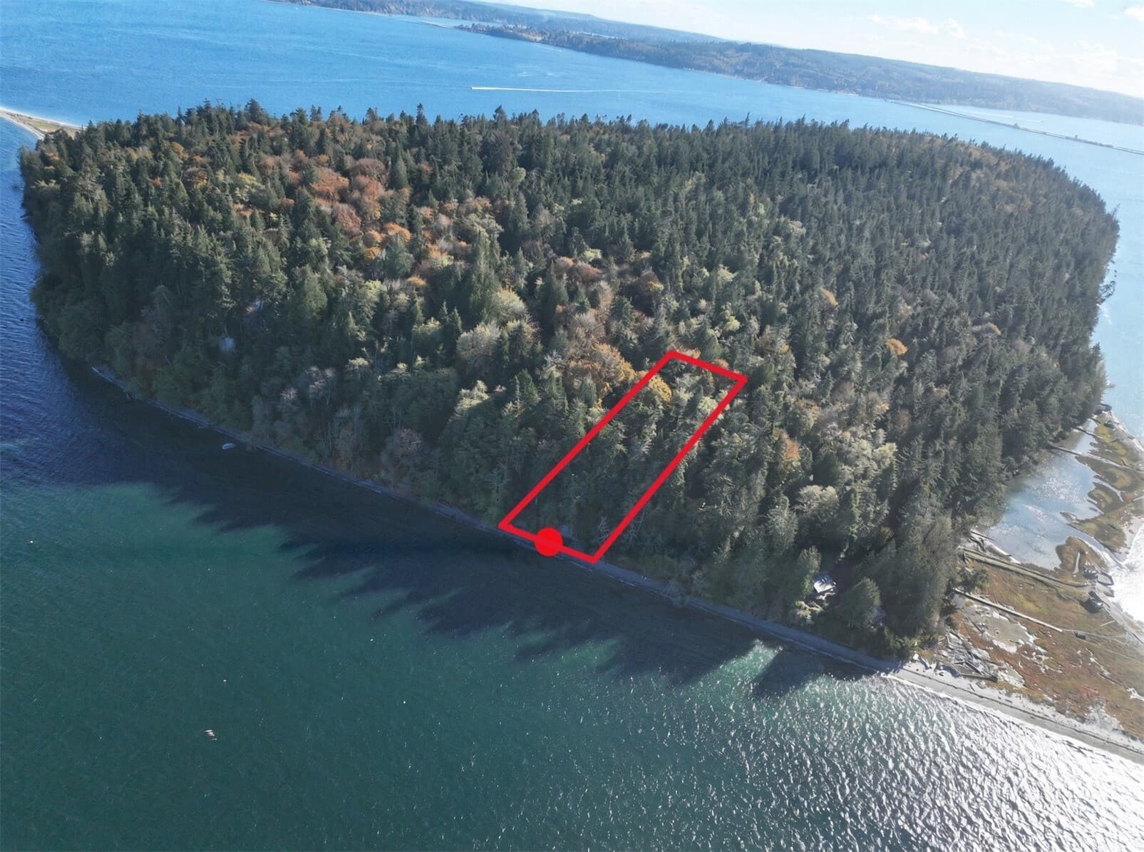
Think Robinson Crusoe meets Swiss Family Robinson! Two adjoining lots, each one 60’x350’ with 120' of north-facing waterfront on Hood Head Island. 2/3 of the land is level but sloped, with the remaining 1/3 being the drop to the water. There are a small handful of off-grid cabins on the island, but it’s mostly vacant and primarily uninhabited. No power, no road, no public water or sewer, though a few wells have been drilled and septic systems installed on the island over the years. Due diligence is critical! This is considered a recreational property. Access is half the adventure. Park at the end of Seven Sisters Rd and paddle about half a mile North to the spit then walk up the boardwalk and into the forest and follow the trail to the property. The safe bet is to paddle. While there are platted county roads on the island, there is no more than a walking trail through a second growth forest where those roads would have been. Hood Head Island will remain a primitive retreat well beyond the foreseeable future. Members of the Port Gamble S’Klallam, Jamestown S’Klallam and Lower Elwha Klallam tribes describe gatherings, ceremonies, fishing and hunting here that predate the first documented European visits in the 1790s. In 1867, the US marine survey named it Hood Head, after the Hood Canal, which Captain Vancouver named in 1792. This is one of the very last undeveloped pieces of land in the Puget Sound, and it is magnificent. Cash or owner financing. Bring a kayak and a plan!
Written by the listing broker. On land this is the primary source for anything beyond price, acreage, and utilities — the MLS publishes no structured zoning, topography, or water-right data — so read it closely, and verify it.
Location
A single point from the MLS, not a boundary. Parcel lines come from the county assessor and a survey — ask us for the map before you walk it.
 MLS #2592575Updated
Listing information is provided courtesy of the Northwest Multiple Listing Service (NWMLS). The information contained in this listing has not been verified by Cascadian Farm and Land and should be independently verified. Data is deemed reliable but is not guaranteed. Copyright © 2026 Northwest Multiple Listing Service. All rights reserved.